Treasure/A Bend in the River

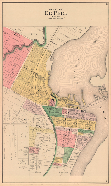
Every issue, we invite one member of the college community to share their delight in an object found on campus. Here, President Emeritus Tom Kunkel speaks to a 19th century plat map of West De Pere, and its East De Pere counterpart. These items have hung on his office wall for many years and serve as a reminder of place and time as they show the changes that have come about in the city over the years.
This “colorized” plat map of West De Pere, dating to sometime in the latter half of the 19th century, was given to me by a friend several years ago along with its East De Pere partner. I hung the two maps prominently on my office wall so that I could, and would, take a moment to look at them at least once a day. I have been faithful to that.
The plats are beautiful in the way that only handmade maps can be. I love their pastel tinting, so meticulously done, as well as the finely scalloped lines that stand in for water.
In this way, in fact, the twin maps are a constant reminder of both place and time. Place, because that eternal Fox River is right there, holding the two halves of our community stubbornly apart as it has for hundreds of years. And time, because while some familiar aspects of our community are already there (note “St. Joseph French Catholic Ch.”), others are not – including our college. It would not appear, as we know, until 1898 amid the excited promise of a new century. With the benefit of historical hindsight, we know something wonderful is coming – even as the maps whisper, yes, but what is yet to come?
July 1, 2017


